

Algorithms for Object Detection and Tracking Using Lidar Data
Lidar is one of the most reliable sensors used for robotics perception and autonomous navigation. Its output can be used for both self-awareness and situational awareness. For example, a lidar point cloud can be processed to estimate the ego vehicle’s motion and detect and track nearby objects.
In this video, the presenter walks you through two examples that show how to detect, classify, and track vehicles by using lidar point cloud data captured by a lidar sensor mounted on an ego vehicle.
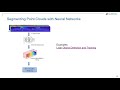
The lidar data is recorded from a highway-driving scenario. The examples illustrate the workflow in MATLAB® for processing the point cloud and tracking the objects. The point cloud data is segmented to determine the class of objects using the PointSeg network. A joint probabilistic data association (JPDA) tracker with an interactive multiple model (IMM) filter is used to track the detected vehicles.
Join us on Facebook Group:
https://www.facebook.com/groups/matlabcodes


No comments